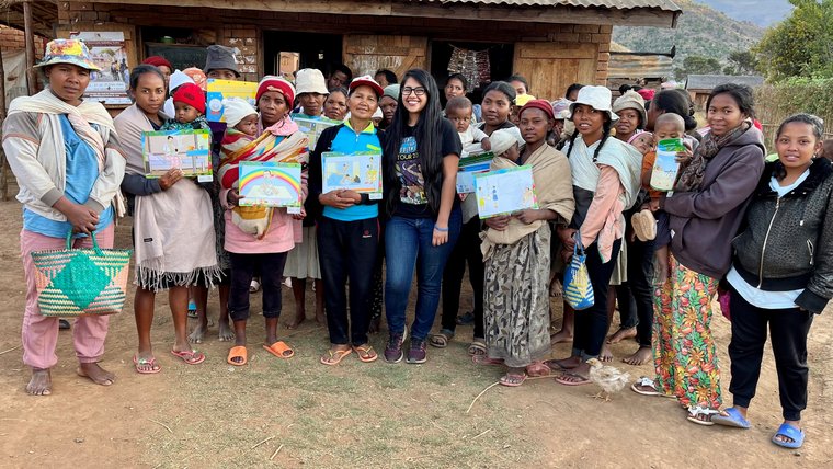
Connecting Over Geography in Madagascar
I am often amazed by Malagasy people’s sense of direction. Whether in dense rainforest or the urban sprawl of the capital Antananarivo, people always seem to maintain a mental map of their exact location. Even inside a building, people will invite you to “sit in the eastern chair” or tell you that you have rice on the southern side of your shirt.
However, people’s sense of location becomes much more abstract when it comes to the world outside Madagascar. Folks often ask me where the United States is, whether all the Volunteers come from the same town, or how far it is from Madagascar to mainland Africa. Inspired by all these questions, I decided to paint a world map outside the middle school where I teach. Excited at the prospect of teaching geography, my school staff quickly agreed. They even offered to help paint it.
Fortunately, Peace Corps offers a grant for this kind of project. After a few months traveling to and from the nearest town with WIFI, my grant was approved. I was ready to begin.
In my experience, no project ever goes quite the way you expect in Madagascar. To get paint, I took a long bus-ride down a bumpy dirty road to Ambositra, a hilly town located in the heart of Madagascar’s highlands. The steep slopes can make carrying fifteen kilos of paint a real pain, but fortunately I had some help. Ambositra is full of rolling wagons that people use to transport goods up and downhill. After buying my paint at the very top of the hill, I waved to a passing cart, and the driver beckoned me to hop on. We rocketed downhill at terrifying speed, the driver expertly steering this way and that as I clung on to the back. It was just like sledding back home, only with trucks and zebu in the way.
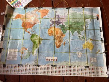
When I returned to site, I realized that I had another problem. Normally, when people paint maps, they project an easily traceable image on the wall. I didn’t have access to a projector (or any electricity to power it), so I decided to do things the old fashioned way. I went door to door in my town, asking if anyone had a world map I could borrow. My plan was to draw a grid on the map that I could then copy onto the wall, but I couldn’t do that without ruining my neighbor’s map. Instead, I used duct tape and string (two Peace Corps necessities) to make an easily detachable grid.
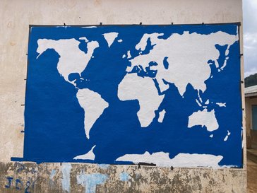
It was finally time to start painting. Not much was going on in my town during Christmas break, so I had plenty of observers and helpers as we first laid on a base of white paint, then sketched out the continents in pencil. The ocean came next, then the painstaking process of outlining and painting each country. As we worked, bystanders asked questions. “Why is Madagascar so small?” “Where are Russia and Ukraine?” A teacher from another school took the opportunity to explain plate tectonics, pointing out the distinctively shaped East African coastline from which Madagascar had split millions of years before.
Once again, Madagascar provided some unique complications. It was the rainy season, which meant the painting had to be done by noon every day so the paint had time to dry before the evening downpour. Fortunately, my town is full of early risers. I often got people knocking at my door at six in the morning saying that they were ready to help.
As luck would have it, a professional painter from the far off city of Mahajanga came strolling by the school just as I was attempting to write the country names. He agreed to help out in exchange for a few of my fine-pointed brushes. My school director liked his work so much that he hired him on the spot to redo all the signs around the school.
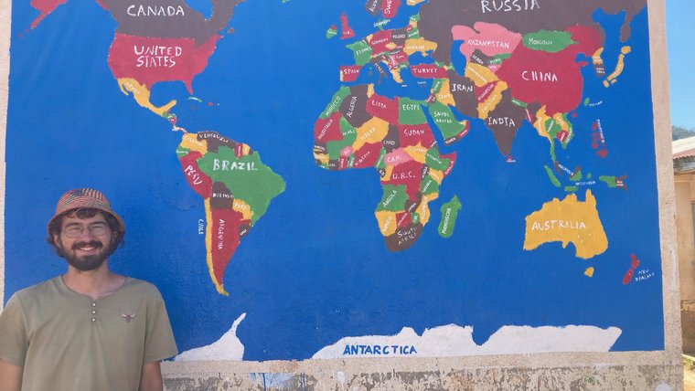
In the end, the map turned out better than I had ever expected. It wasn’t perfect (sorry Balkans), but I still admire it every morning when I arrive at work. I often see a small crowd of students gathered around it, finding countries they had heard about on the radio or seen play in the World Cup. And when people ask me where I’m from, I finally have something to point to.
My favorite reaction came from one of the local elders, who leaned on his staff as he inspected the map, then nodded in satisfaction, “Good. It’s a way we can remember you even after you go home.”