

Exploring Home Across the Globe Lesson
In this lesson, students will have the opportunity to “travel” around the world and explore how houses are built and how homes differ from one community to another.
Background
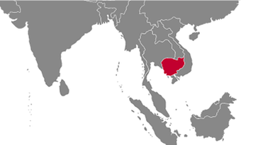
Students will view three videos which were filmed by Peace Corps Volunteers as part of the video series, Highlighting Home. Students will see what makes a place "home" in Cambodia, Guinea, and Colombia.

Highlighting Home: Cambodia
In Cambodia, close-knit families make a place a home. Watch this video to learn some Khmer words for family members.

Highlighting Home: Guinea
Watch to learn more about the typical day of a woman in Guinea, and her efforts to create a home.

Highlighting Home: Colombia
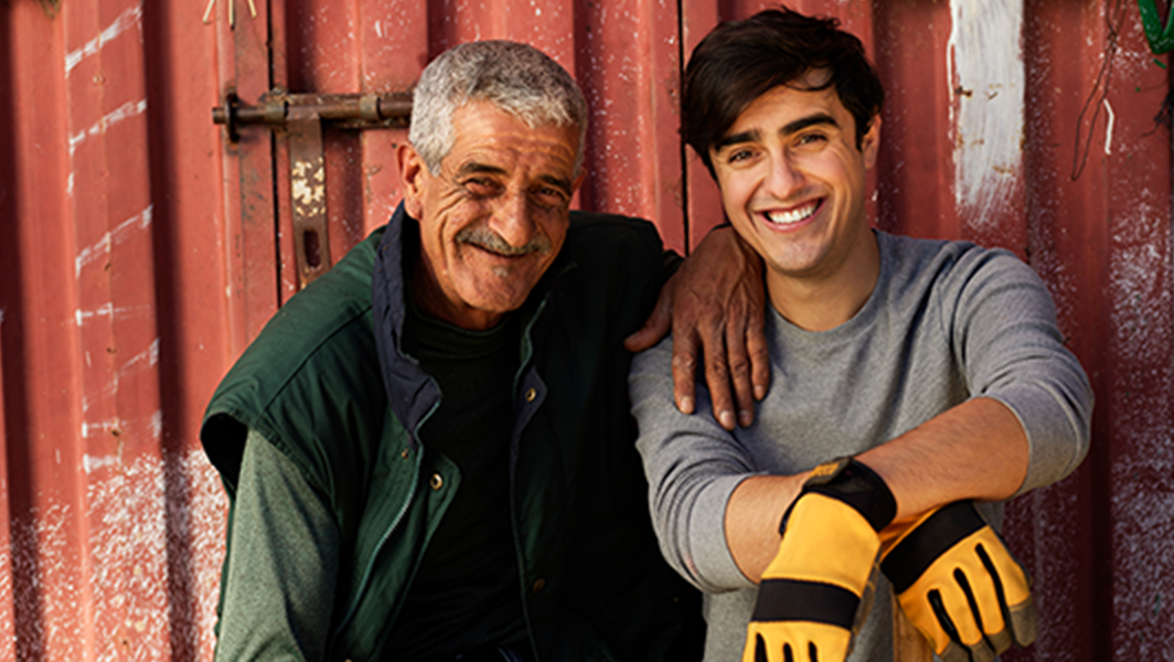
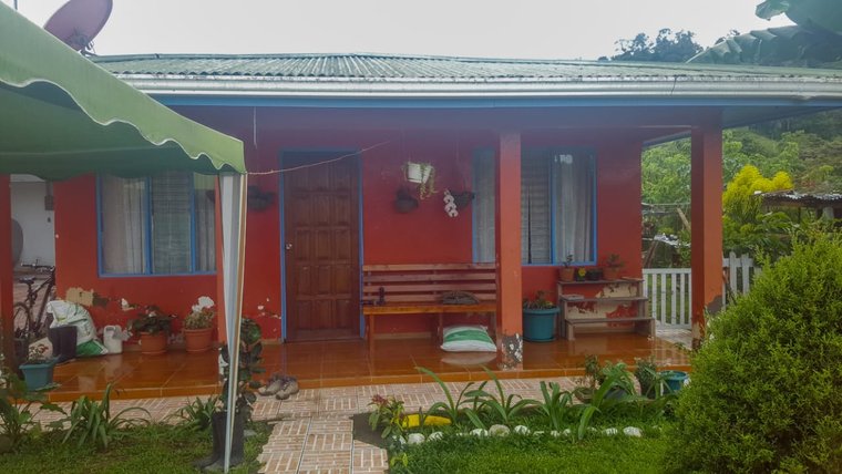
In Colombia, it’s values like love, respect, and mutual care that make a home. Join a Peace Corps Volunteer as she highlights the meaning of home in Colombia.
Objectives
Students will be able to:
- Explain the difference between a house and a home.
- Identify ways in which weather, physical geography, socioeconomic status, available resources, and population density impact the style and construction of houses around the world.
- Create an interactive digital presentation to demonstrate their knowledge.
Materials
- Exploring Home Educator Guide [PDF] with step-by-step lesson instructions
- Exploring Home Student Handouts [PDF]
- Videos for Cambodia, Guinea, and Colombia.
- Laptop or device connected to the internet
- Access to graphic editing or presentation software like Prezi, Canva, Google Slides, Keynote, or PowerPoint
Procedure
Part 1: Engage (Think, Pair, Share)
-
Activate student involvement by posing the question: “What is ‘home’?”
- Let students first think about this question individually.
- Have students draw a picture of their home or their idea of home. Conversely, students could create a mind map of their ideas about what a home looks like.
-
Then have students exchange their ideas in pairs. Students can add ideas to their own conceptions of home after conversing with their partners.
-
Finally, have students share in a class-wide discussion what a home is. (See Educator Guide page 4 for sample questions to use to facilitate discussion.)
Part 2: Explore
-
Start by asking students if they know where the countries of Cambodia, Guinea, and Colombia are located. Show the three countries on a world map and point out that each is located in a different content.
-
Ask students to make guesses as to what typical houses might look like in each of these countries.
- Point out that houses might look different in rural areas versus in big cities. (Help students avoid overgeneralizations or stereotypes.)
- Show a few pictures of a variety of houses in each country to see if students' guesses were accurate. (These can be drawn from the internet.)
- Compare and contrast some houses in each country.
-
Watch the three short videos about home in Cambodia, Guinea, and Colombia. (You may need to play each video twice in order to give students enough time to complete the accompanying handout.)
-
As students watch the videos, they will fill in the “Highlighting Home” Student Capture Sheet (page 1 of Student Handouts).
Part 3: Investigate
-
Facilitate the students’ investigation into the varied world of global architecture by choosing three different types of houses from three distinct climate zones.
-
They will start by researching the history of each type of house to understand its origins and evolution.
-
Next, they will explore the materials used in construction, considering why these materials are ideal for the specific climate zone and how local resources influence their choice.
-
This investigation will help students see the practical aspects of building houses that can withstand local weather conditions from the intense heat of deserts to the heavy rains of tropical regions.
Part 4: Create
-
Guide students as they create an interactive, Google Earth-style presentation. Students will use presentation software such as Prezi, Canva, Google Slides, Keynote, PowerPoint, or a combination of these to compile their information and design a presentation.
-
This dynamic student product will allow viewers to zoom in on different areas of a world map using hot spots and explore the houses that students have researched.
-
This product can be as simple as a four-slide presentation or more complex if students have additional images, research, or other content they would like to add.
-
The main slide of the presentation would be a world map.
- Students will add markers over the areas on the map where the houses they researched are located.
- Each marker would then be linked to the slide with corresponding information about that house.
-
Students will be graded using the Rubric found on page 2 of the Student Handouts.
Part 5: Reflect
-
Invite students to reflect upon their learning experience by considering one or more of the following prompts:
- What was the most surprising thing you learned about houses in different parts of the world?
- Can you draw any parallels between the houses you studied and houses in your own community? What similarities or differences did you notice?
- Reflect on how this project changed or deepened your understanding of what makes a house a home.
-
Students could respond to these prompts in a journal, on a class discussion board, on an exit ticket, or on a sticky note wall.
Extensions
- Have students film a video of their own home! In the video, they should interview a friend or family member about what, in their opinion, makes a house a home.
- Language classrooms: ask students to film their video in the language that you are studying! They can take you on a tour of their home and say the name of each room, and possibly what activities they do in that room (depending on their level of proficiency).
Standards
National Social Studies Standards
Theme 1 - Culture: Social studies programs should include experiences that provide for the study of culture.
- Through experience, observation, and reflection, students will identify elements of culture as well as similarities and differences among cultural groups across time and place.
Theme 9 - Global Connections: Social studies programs should include experiences that provide for the study of global connections and interdependence.
- Through exposure to various media and first-hand experiences, young learners become aware of how things that happen in one part of the world impact other parts of the world.
Next Generation Science Standards
ESS2.D: Weather and Climate
- Weather and climate are influenced by interactions involving sunlight, the ocean, the atmosphere, ice, landforms, and living things. These interactions vary with latitude, altitude, and local and regional geography, all of which can affect oceanic and atmospheric flow patterns. (MS–ESS2–6)
- Because these patterns are so complex, weather can only be predicted probabilistically. (MS–ESS2–5)
- The ocean exerts a major influence on weather and climate by absorbing energy from the sun, releasing it over time, and globally redistributing it through ocean currents. (MS–ESS2–6)